


The largest island, Viti Levu (pronounced Vee-tee Lay-vu) is home to 70% of the population (about 600,000) and is the hub of the entire archipelago. It measures 146 kilometers long and 106 kilometers wide and has an area of 10,389 square kilometers. In the realm of Pacific islands, it is exceeded in size only by New Caledonia and the Big Island of Hawaii.
Areas
Location
Around Viti Levu
For ease of use, I’ve divided this large island into four main sections—Nadi, Suva, Rakiraki and the Coral Coast. The Mamanuca Group is also technically part of Vivit Levu but the purposes of this website I’ve given them a separate section.
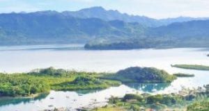
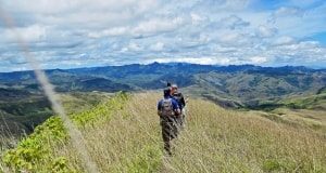
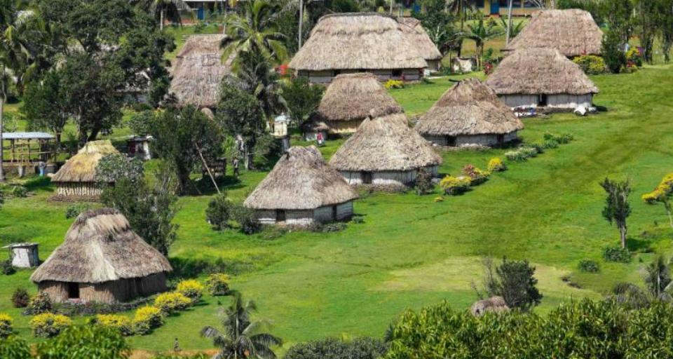
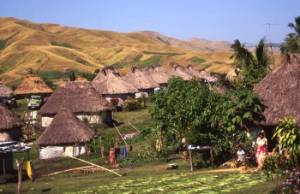
Commensurate with the island’s size is its importance. Viti Levu’s rich river valleys (such as the Sigatoka Valley pictured at right) support the country’s densest population centers. Extensive sugar lands lie on its western and northern coasts. Gold mines, dairy farms, light manufacturing and the most important industry – tourism – contribute to its wealth. In addition, the island is the hub of air and sea communications in the Southwestern Pacific.
Viti Levu has evolved geologically into its present form through a long and complex series of events. During protracted periods it lay deep beneath the sea; at other times much of it was buried under massive amounts of lava and other volcanic materials. The land was tilted, broken and pushed every which way, yet it emerged as a symmetrically shaped island with a mountain barrier forming a roughly north-south axis or backbone.
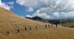
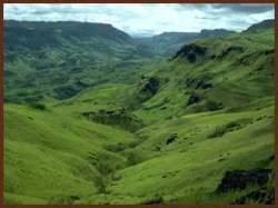
 The island lies in the path of the prevailing trade winds, resulting in a heavy rainfall over the windward slopes of the east, and leaving the countryside to the west generally sun-drenched and dry. The transition from the wet to the dry zones is abrupt, and can best be seen from the air. In general, the area of the island east of the north-south mountain axis is dense and green with vegetation, while the area to the west is light yellow-green or yellow and brown, according to the season.
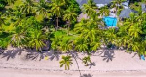
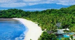
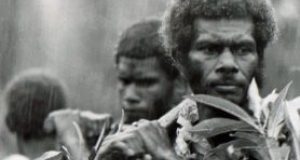
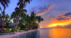
Viti Levu has it all—cities, offshore resorts, cane fields, nightlife, low life, villages and as elsewhere in Fiji, no shortage of friendly local people.
Visitors to Fiji will no doubt arrive at Nadi International Airport, a dusty farming and tourism center on the west coast of Viti Levu that is rapidly growing in stature. There are a plethora of accommodations in Nadi. Be sure and check the Nadi page for lodging and restaurant recommendations.
Just to north, 20 minutes away by car, is Lautoka, the second largest city and the second port of entry. The dry, western side of the island, known locally as the `Burning West’, is the site of most of the tourist resorts as well as extensive sugar lands.
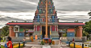
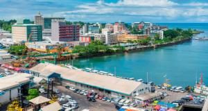
On the Southeastern shore is Suva, the largest city, the chief port and the capital. It’s also the cultural, business and government center. Refer to the Suva page for information on accommodations, restaurants and other activities.
Driving & Highways
 Viti Levu has one main road around its perimeter. Most of this road is well maintained, especially the stretches between Sigatoka and Nadi, and Suva and Pacific Harbour, which make up a comparative superhighway. Lesser utilized portions of the road may be in a poorer state of repair, due to flooding, hurricanes or whatever natural disasters may have just occurred.
The highway circling the island is actually divided into two sections: Queens Rd, which covers the southern coast from Suva to Lautoka; and Kings Rd which includes the northern coast, also from Suva to Lautoka. Of the two, Queens Rd is the shorter route to Suva (221 km). A leisurely driving time is about three hours. The northern route is in poorer shape, longer (265 km) and certainly less traveled by tourists. Both roads are now completely sealed around the perimeter of the island.
In theory the island could be circled in a day, but this would involve maniacal driving and certainly wouldn’t be any fun. The best suggestion is to take your time and do it in two, three or even four days, stopping along the way to see all the points of interest and chatting with the local villagers. There are some interesting inland and coastal turn-offs mentioned in this guide, but do not expect sealed roads on these detours. Inclement weather (not unusual in Fiji) may make them even worse, so be forewarned. Drivers should also keep a lookout for locals walking along the edge of the highway and ubiquitous stray livestock at any time of the day or night. Note that the highway is not quite so good on the topside of the island, past Rakiraki.
Visitors should also note that the climate varies significantly from east to west. The western side of the island is sun-drenched and dry whereas the verdant and often soggy eastern side gets as much as 100 inches of rainfall a year.
Viti Levu is Fiji’s largest island. You’ll find activities and accommodations listed geographically. Below are some general suggestions. More detailed ideas (as well as accommodations) are listed in the various sections (Suva, Nadi, Lautoka, etc.)
A Few Things to Do
Rent a car and take two days to drive around the island. Overnight it at the Rakiraki or Tavua Hotel.
- Nadi: Day trip to the Mamanuca Islands or the Nausori Highlands. The main thing is to use Nadi as a jumping-off point to see the nearby environs.
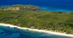
- Lautoka: Visit Garden of the Sleeping Giant or the Offshore Resorts in the Mamanucas. Consider spending a day or two on Nananu-I-Ra Island which is about two hours by bus from Lautoka.
- Rakiraki: See the North Coast of Viti Levu, the least adulterated section of the island. Note the wide swath of sugar can and pastoral landscapes. Stay overnight at the colorial era Rakiraki Hotel and jump on a boat to Nananu-i-Ra, a resort island amenable to the most modest budget.
- Suva: See the Fiji Museum, check out the nightclubs, and visit the Cultural Center at Pacific Harbour. If you have the notion, jump on a plane and take a day trip to the Old Capital of Levuka, a ten minute flight from Suva.
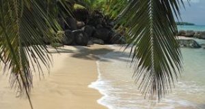
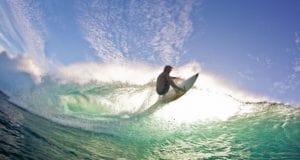
- Sigatoka: Drive or bus up the Sigatoka Valley and picnic on Natadola Beach or see the Sigatoka Sand Dunes. There is also a great beach (and surfing) at the mouth of the Sigatoka River.
Leave a reply