

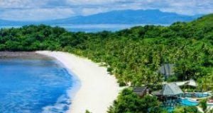


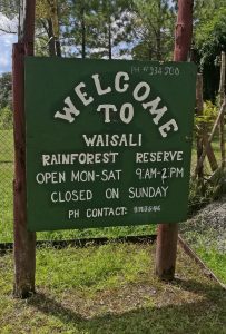
About Kadavu
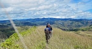
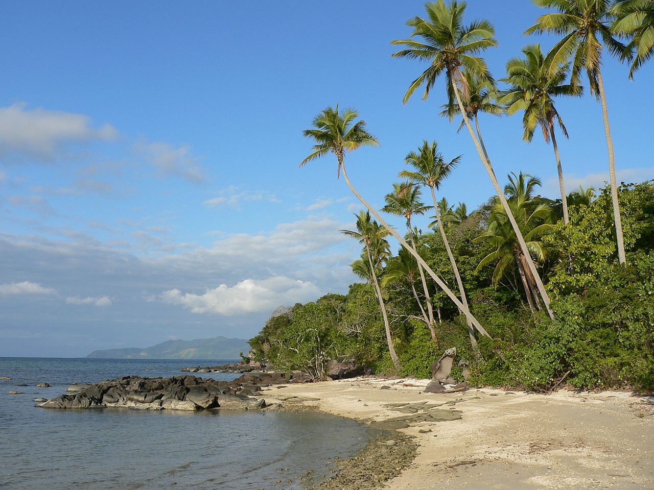
Kadavu (pronounced Kahn-da-voo), has a population of approximately 8700 and lies only 88 kilometers south of Suva. Kadavu is approximately 48 kilometers in length and varies in width from 365 meters to 13 kilometers. Its area is 411 square kilometers, just a bit less than Taveuni. Kadavu has several high mountains and numerous precipitous cliffs. In short it is a rugged island with few roads, which makes water taxis the prime mode of transportation.
The airport, a government station and a health center are located at the eastern end of the island in the village of Vunisea. Note that most of the resorts on Kadavu are nowhere near the airstrip-you must be met and ferried another 30- to 60 minutes (or more) by small craft to your destination.
One thing the potential visitor needs to know that despite its proximity to Viti Levu, Kadavu is very isolated. There are no roads, no electrical grid, and no public water system. Mobile phone service with Vodafone, can be very sketchy. (Digicel, I’m told is better on Kadavu).
Bottom line: Kadavu is remote but adventurous visitors will be rewarded many times over with hospitality and the opportunity to engage in village life.
Transportation is strictly by launch, which can get expensive. Food, unless it’s locally grown in the garden or harvested in the sea, has to be brought in, and by definition is going to be expensive. Some properties will allow BYOB. That’s both the good news and the bad news. Because of it’s isolation and lack of infrastructure, Kadavu is still very much undeveloped and if that’s appealing, well you’re in the right place.
Location
Definitely Do Not Miss
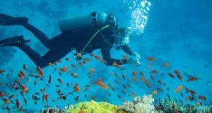
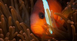
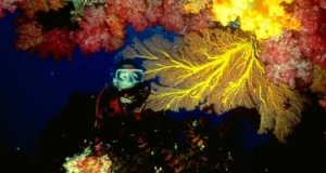
Diving is first class on this island and all the resorts have dive operations. Visit a village – overnight stays can be negotiated through some of the resorts.
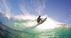
Surfing is good but it will take a long boat ride to get you to a break. You’ll need to organize that with your resort.
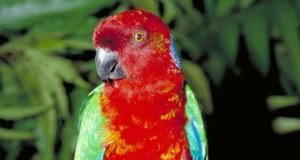
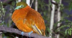
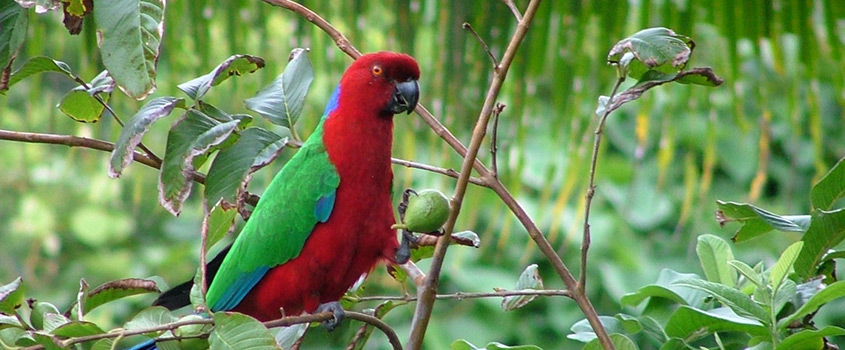
Bird watching is world class. (Keep your eye out for the local parrots which are ubiquitous).
Additional Info
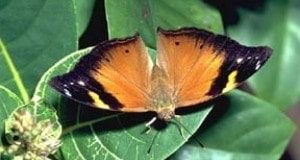
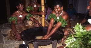
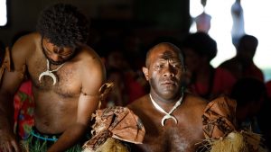
Despite its proximity to the population center of Viti Levu, the population of Kadavu is deeply conservative. Perhaps the conservatism can be traced to the difficulty of getting around the island and the resulting isolation of its communities. Though remote, Kadavu is well known by divers for its rich diversity of undersea life, particularly in the Astrolabe Reef. Likewise there is a great deal of terrestrial flora and fauna of interest, particularly the birds. The colorful Kadavu Parrot, which is now a protected species, can be easily observed.
Over the last five to ten years a number of mid-range properties (as well as one uber-deluxe resort) have sprouted up on Kadavu. For visitors interested in getting away from the typical tourist haunts of the Nadi area, Kadavu is a good option. If you are not a diver, surfing during the winter months is quite good. Kadavu can be reached by air from Nadi and Suva.
There is also ferry service from Gounder’s Lomaiviti Princess on Tuesdays and Fridays from Suva (arriving respectively on Wednesdays and Saturdays). Prices are F$44 for economy and F$75 for first class. I suggest you splurge for first class. When economy seats are full, passengers are sprawled out out on any surface they can find.
Kadavu Geography
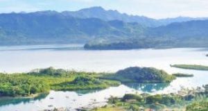
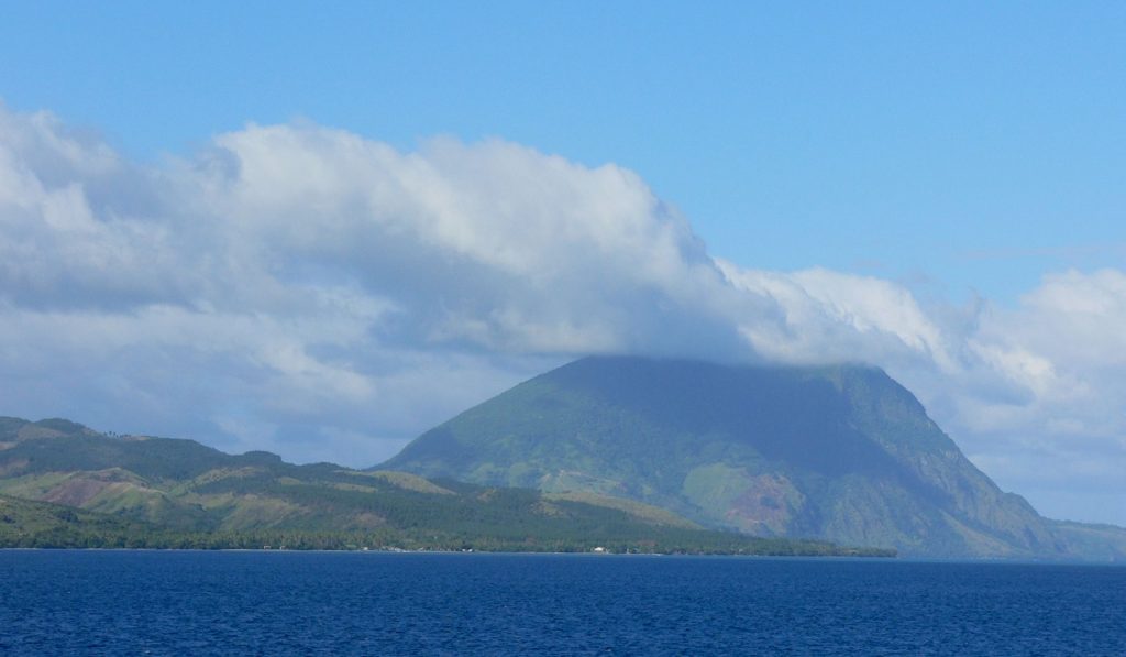
The Kadavu group is volcanic in nature, the main island being Kadavu, which is 93 km long and varies in width from several hundred metres to 13 km. It has an area of 408 sq km. All its coasts are deeply indented, some bays biting so far into the land that they almost divide the island. One geographer has suggested that the shape of Kadavu resembles that of a wasp, with the head, thorax and abdomen linked by narrow waists.
Thus Vunisea (the administrative center), Namalata Bay and Galoa Harbor are separated by only a sandy isthmus standing a few meters above sea level; and at Vunisea the heads of Daku Bay and Soso Bay are within 1100 meters of each other, with only a low ridge between.
This same characteristic occurs elsewhere on the island to a varying degree, Kadavu’s coastline above Dive Kadavu Resort; the shape and arrangement of these bays suggests that they may be drowned valleys.
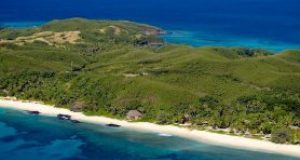
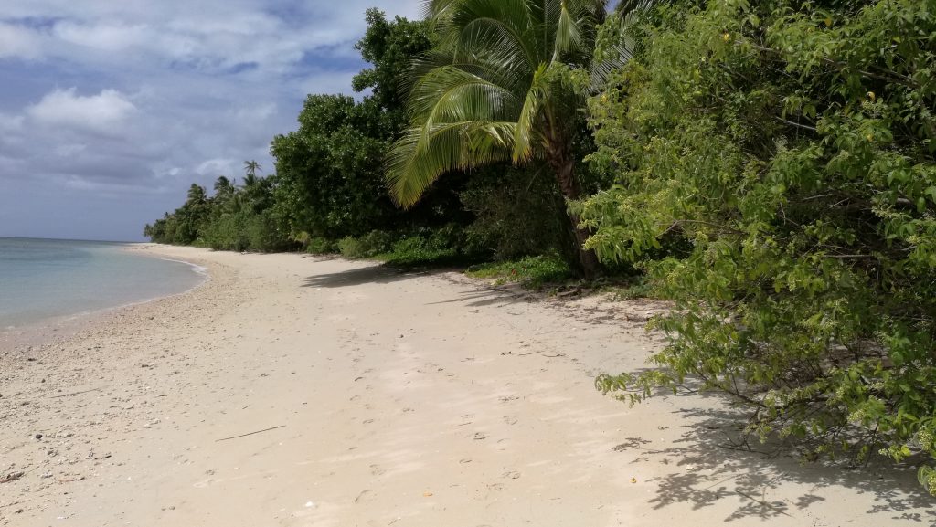
Kadavu is rugged and its mountains are high for so narrow an island. Several peaks rise more than 600 meters, while many are half that size. Coasts are generally fringed with coral reefs, the most famous being the 48-km loop of the Great Astrolabe Reef on Kadavu’s northern extension.
The island is divided into several regions:
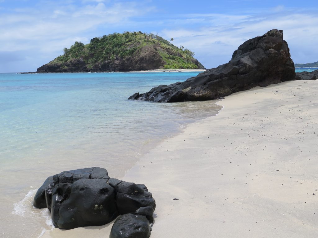
At the very north is the Ono Island group. Enclosed by the Great Astrolabe Reef, it has wonderful fishing and diving. Because there are great white-sand beaches and a cruise ship tender dock, cruise ships sometimes stop at Dravuni Island, which is near the northern tip of the group. There is also a fisheries station here. Yachts find the area appealing, but must first get a permit to stop there. Just south of Dravuni is Yakuve Island on which Kokomo Island Resort, an exclusive property, is located.
Western Kadavu
The western end is 24 km long and dominated by 822 meter Nabukelevu (Mt Washington). Flanking the mountain on the southern side are lovely crescent-shaped beaches. From this peak a spur runs west to Cape Washington – a rocky bluff crowned by a lighthouse. The range continues, terminating in a steep cross range overlooking Galoa Harbour. One of the most beautiful villages in Fiji, Daviqele, is in this area.
Northern Kadavu
The northern part of this region is called Yawe, known for its large earthenware cooking pottery, still crated by the women of Nalotu village. Most of the northern coast, extending to the Sanima and Yale districts further east, is dry and sheltered by reed-like vegetation with scattered reefs offshore. Much of the goat raising is done here. The link between the island’s western end and its center is Namalata Isthmus, known to Fijians as Na Yarabale (literally, ‘the place where the canoes are dragged across’). In the same area is the village of Namuana, home of the people who can call turtles from the sea.
Opposite the isthmus on the southern side is Galoa Harbour, and in the harbour is 2-1/2-km-long Galoa Island (after which the harbour was named). On the southernmost point of this part of the island is a tiny islet, Tawadromu, which was once home to an American Indian – the sole representative of his race among the mixed population of the period. Why he stayed and what he was doing there is anyone’s guess.
Southern Kadavu
Further along the southern coast is the Naceva area, perhaps the most untouched and primeval in nature, with forests, mangrove swamps along the water’s edge, many waterfalls and an ever-present mist hanging over the mountains.
Leave a reply